
Maps and panoramas
We preserve maps and related depictions of the whole world from the early modern era to the present day. Our collection is one of the largest in Central Europe.
Competence centre for the history of maps
In the Department of Maps and Panoramas, we are at your disposal as specialists to answer questions about the history of cartography. We work closely with the Centre for Historical Mediology (UZH). In our reading room, we provide you with professional support and access to the largest public library in Switzerland with a focus on map history (around 10,000 monographs).
Latest news


Maps and panoramas
Holdings
Conduct research on topographic studies from around the world, all the way back to the beginnings of cartography, using:
- Maps
- Atlases
- Location directories
- Panoramas
- Reliefs
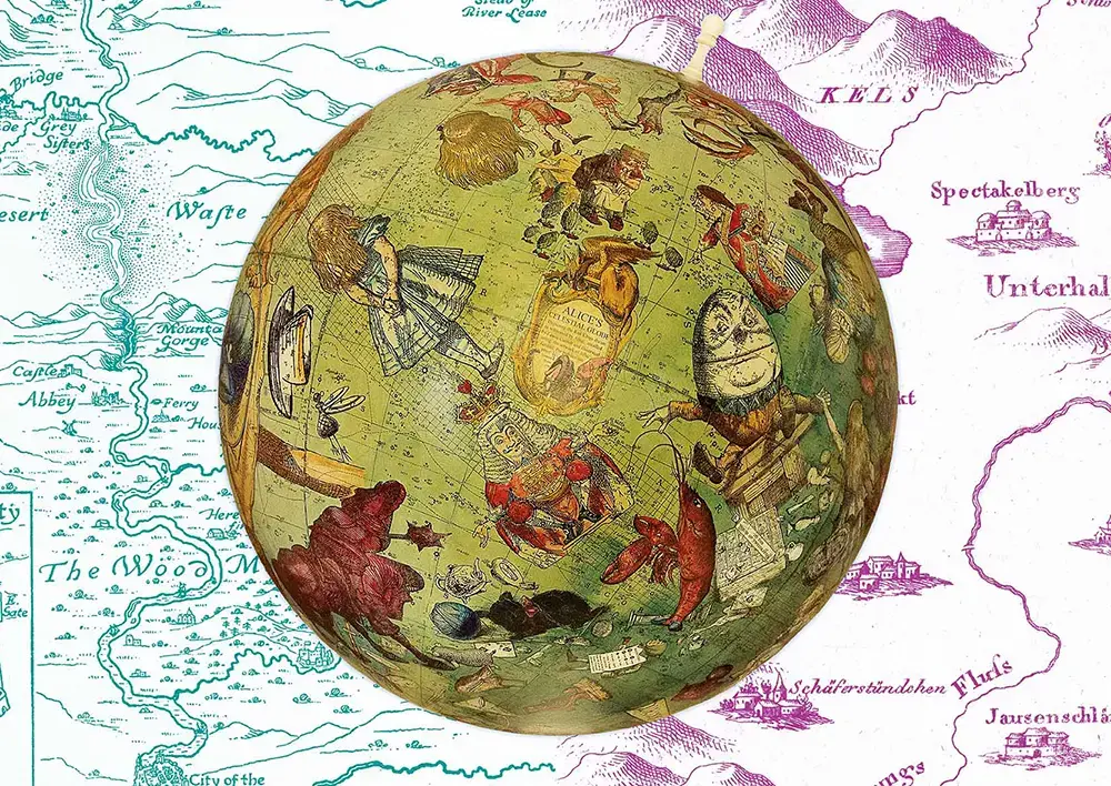
- Globes
The total collection currently comprises about 340,000 map sheets. Selected holdings are available online, such as our 1,200 or so manuscript maps. As hand-drawn or painted maps, these unique items are also very valuable cultural artefacts.
Certain works in our map collection were owned by the city library back when it was founded in 1629. In the 19th century, the collections of Leonhard Ziegler, the Mathematical-Military Society and the Kartenverein (‘map association’) were added. The holdings of the Naturforschende Gesellschaft followed in the 20th century. Since then, we have been systematically expanding the collection.
Publisher archives
Our collection contains the archive of cartographic works produced by Orell Füssli Kartographie AG (OFK) and Matthieu-Faksimileverlag. We are indexing these documents on an ongoing basis for you.
Personal archives
We hold the pre- or posthumous bequests of the following cartographers and panorama artists:
Image gallery
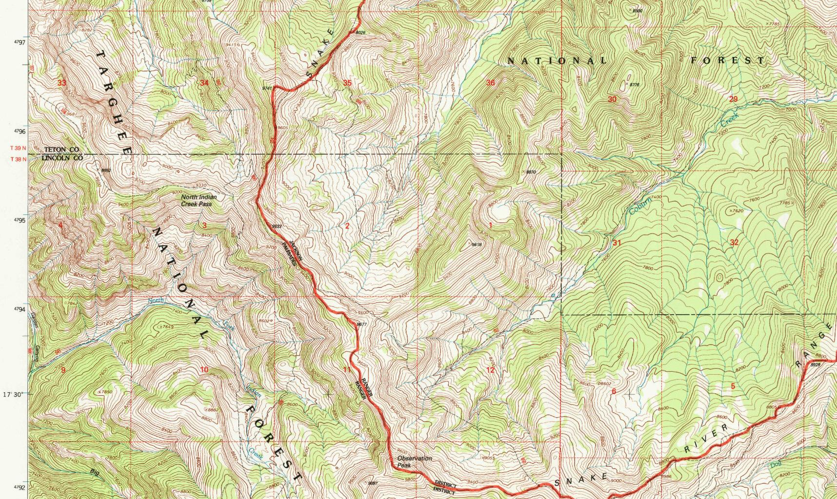
Grand Teton National Park (WY), Observation Peak sheet in USA 1:24,000, Reston 1996. (Shelf mark: 4 Pg 98: 1)

Manuscript panorama of the city of Zurich, viewed from Schönberggasse, around 1844. (Shelf mark: S Z Zürich II 70)
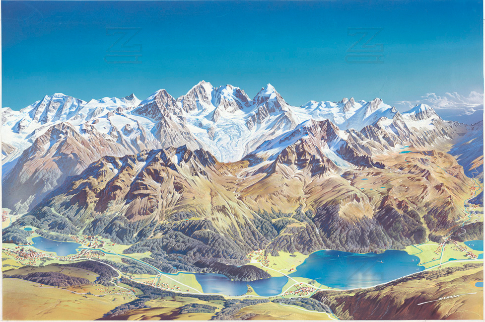
Corvatsch, Silvaplana, St. Moritz – manuscript template for the brochure by Heinrich Berann. (Shelf mark: MK 2172)
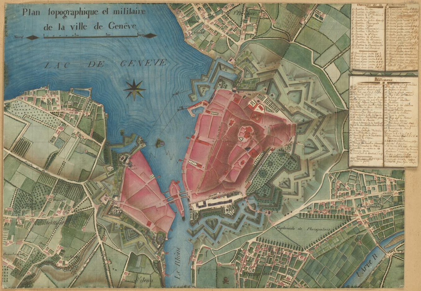
Manuscript map of Geneva around 1790. (Shelf mark: MK 2127)

Chinese world map ‘Kun yu tu’. Beijing, 18th century (shelf mark: Wak 342)
Cataloguing

Kartenportal.CH ist der zentrale Einstiegspunkt für die Internetrecherche nach gedruckten und digitalen Karten der Kartensammlungen (u.a. der Zentralbibliothek Zürich), Archive und Geodatenanbieter in der Schweiz.
Kartenportal.CH offers a research and geographical search function for maps from around the world held by the ZB and other Swiss libraries.

swisscovery bietet Zugang zu den Beständen von rund 500 wissenschaftlichen Bibliotheken in der Schweiz. Enthalten sind physische und elektronische Bücher, Zeitungen und Zeitschriften, aber auch Non-Book-Materialien und Millionen von elektronischen Artikeln.
swisscovery UB und ZB Zürich erlaubt die Recherche im gesamtschweizerischen Bestand und eine gezielte Recherche in den Beständen der Universitätsbibliothek (UB) und der Zentralbibliothek (ZB) Zürich.
swisscovery enables you to search the online inventory of our maps and literature in the library catalogue.

Sie finden hier Archivmaterial (inkl. Nachlässe), Bildmaterial, Alte Drucke und Rara, Dokumentensammlungen, Filmmaterial, Handschriften, Karten, Musikaufnahmen, Musiknoten, Textaufnahmen sowie Einträge in Kantonsbibliographien. Es handelt sich um einen Metakatalog, der auf verschiedene Datenpools zugreift.
Beteiligte Institutionen:
- Aargau, Kantonsbibliothek Aargau
- Basel, Schweizerisches Wirtschaftsarchiv
- Basel, Universitätsbibliothek
- Bern, Universität, Institut für Medizingeschichte: Archiv und Sammlung Hermann Rorschach
- Bern, Universitätsbibliothek
- Beromünster, Chorherrenstift
- Frauenfeld, Kantonsbibliothek Thurgau
- Luzern, Zentral- und Hochschulbibliothek
- Solothurn, Zentralbibliothek
- St. Gallen, Kantonsbibliothek inkl. Vadianische Sammlung
- St. Gallen, Stiftsbibliothek
- Trogen, Kantonsbibliothek Appenzell Ausserrhoden
- Zürich, Zentralbibliothek
- Zofingen, Stadtbibliothek
swisscollections offers an optimised keyword search for map-related materials.
Advice & mediation
Can’t find what you’re looking for in the catalogue? We would be happy to check in our inventory: we have not yet listed all our map materials online.
Maps reading room
Our reading room is located on the first floor of the Predigerchor. Our specialist staff are on hand during afternoon opening hours (2–6 pm, Saturdays 2–4 pm). There are also eight workstations and a research station available for use. We are happy to offer you advice there in person.
The holdings of the map collection are not available for loan, but you can make copies of the majority of the reading room collection. A photocopier is available. Please note our Terms of Use.
Introductions and courses
We hold a regular Coffee Lecture on the topic of Kartenportal.CH, offering an introduction to map research in a short session. You can also find upcoming events in our events calendar.
Don’t want to miss any events in the future? Subscribe to the ZB newsletter to stay in the loop!
Contact
Maps and panoramas
Digitised Material
The following holdings have been digitised and can be accessed via our various platforms.

Auf der Plattform e-manuscripta.ch werden digitalisierte handschriftliche Quellen aus Schweizer Bibliotheken und Archiven, unter anderem auch aus der Zentralbibliothek Zürich, öffentlich und kostenlos angeboten. Die Handschriften und Archivalien stammen aus mehreren Jahrhunderten, das Spektrum reicht von Texten, Briefen und Archivgut über Musikhandschriften bis hin zu Karten, Plänen und anderen graphischen Materialien.
e-manuscripta hosts hand-drawn maps and panoramas up to 1900.

Auf der Plattform e-rara.ch, einem Projekt der Elektronischen Bibliothek Schweiz e-lib.ch, werden digitalisierte alte Drucke aus Schweizer Bibliotheken, unter anderem auch aus der Zentralbibliothek Zürich, öffentlich und kostenlos angeboten. Als erster inhaltlicher Schwerpunkt werden die Schweizer Drucke des 16. Jahrhunderts digitalisiert und aufbereitet. Diverse thematische Kollektionen von gedruckten Büchern sowie gedruckte Karten aus dem 16. bis 19. Jahrhundert erweitern das Angebot.
e-rara offers printed maps and panoramas as well as maps from our magnificent atlases.

Old Maps Online ist eine Plattform, die es ihren Nutzenden ermöglicht, alte Karten aus Bibliotheken und Archiven auf der ganzen Welt zu entdecken und zu erforschen. Die Plattform sammelt eine Vielzahl von hochauflösenden alten Karten und stellt sie in einer nutzungsfreundlichen Oberfläche zur Verfügung. Nutzende haben die Möglichkeit, nach Orten und Zeiträumen zu suchen, ohne die Institution zu kennen, die die Originalkarte besitzt.
Historical maps are available on Old Maps Online.

Der Kanton Zürich verfügt über einen umfangreichen Bestand an Geodaten, das heisst an Daten, die einen räumlichen Bezug aufweisen. Eine Vielzahl an digitalen Karten des gesamten Kantonsgebiet stehen zur Konsultation zur Verfügung, darunter Übersichtskarten, Ortspläne und Zonenpläne. Diese sind nach 21 übergeordneten Themengebieten strukturiert, die zum Beispiel Bauten, Boden oder Flora und Fauna umfassen.
Geographical information and maps on various current and historical topics can be retrieved and visualised on the GIS browser of the canton of Zurich – including old maps of the Zurich area from the Zentralbibliothek.
Order digital copies
Can’t find the digital copy you’re looking for on a platform? Need a high-quality print template? Please contact us. On request, we can produce digital copies for a fee for research purposes and publications.