Across space and time
More than 2,500 historical maps of Zurich and Switzerland held by the Zentralbibliothek Zürich’s Map Department have been georeferenced by volunteers.
This fascinating journey of discovery through 400 years of precious maps was also a trip back into the history of where we live: a team of volunteers georeferenced all the maps in record time by identifying matching points on present-day and historical versions. These were then equalised to make them easier to compare with current or other historical maps. The georeferenced map material is now available to all via the Old Maps Online platform.
Maps dating from the 16th to 19th centuries that are already accessible to the public as digitised versions on the e-rara.ch and e-manuscripta.ch platforms were selected for the project. “Across space and time” is part of the Zentralbibliothek Zürich’s strategic focus on citizen science.
How does georeferencing work?
The process of matching maps to geographical locations on the “Georeferencer” web platform was intuitive and did not require any prior knowledge. Volunteers compared an old map with a modern one and marked points that they could identify on both, such as corners of buildings, confluences of waterways and traffic intersections.
In addition to a short video tutorial you can find instructions for the most important steps here. The web platform also contains an overview of all the georeferenced maps from the ZB’s holdings.
Travels through time in the canton of Zurich

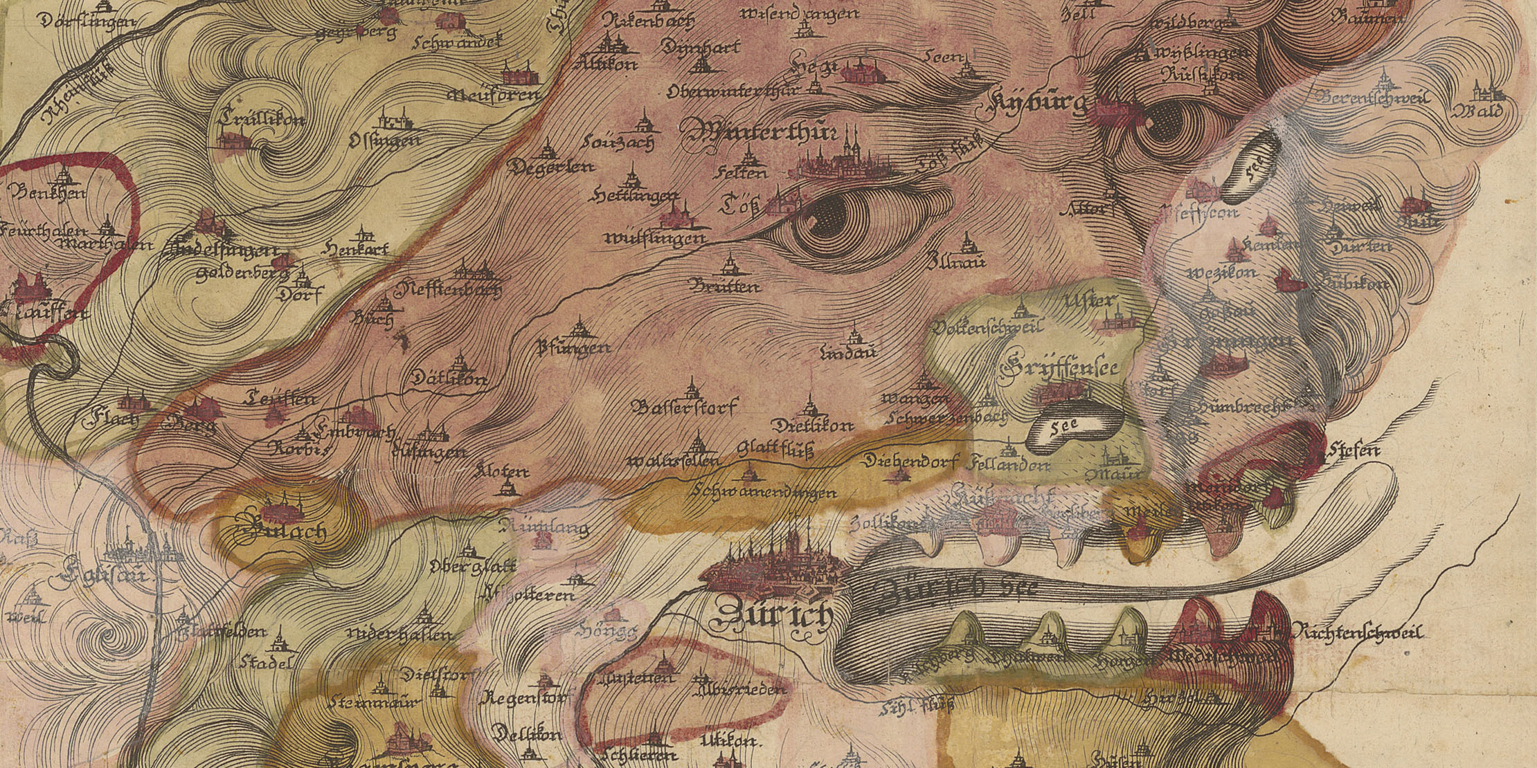
The selection of maps comprised 840 examples that essentially cover the territory or parts of the present-day canton of Zurich. Maps do more than simply help us find our way around: they are also instruments of power. For example, the 1698 map of the territory of Zurich by Johann Heinrich Streulin, with its north-east orientation, features the emblem of Zurich: the lion’s head.
Maps made in Zurich

This sub-fonds comprises over 1,000 maps that were designed or printed in Zurich. In addition to maps showing the territory of other cantons, there are maps of Switzerland as well as city plans and bird’s eye views – such as Johann Jakob Scheuchzer’s bird’s eye view of the city of Lucerne, “La ville de Lucern, en Suisse”, from 1723.
Old maps of Switzerland
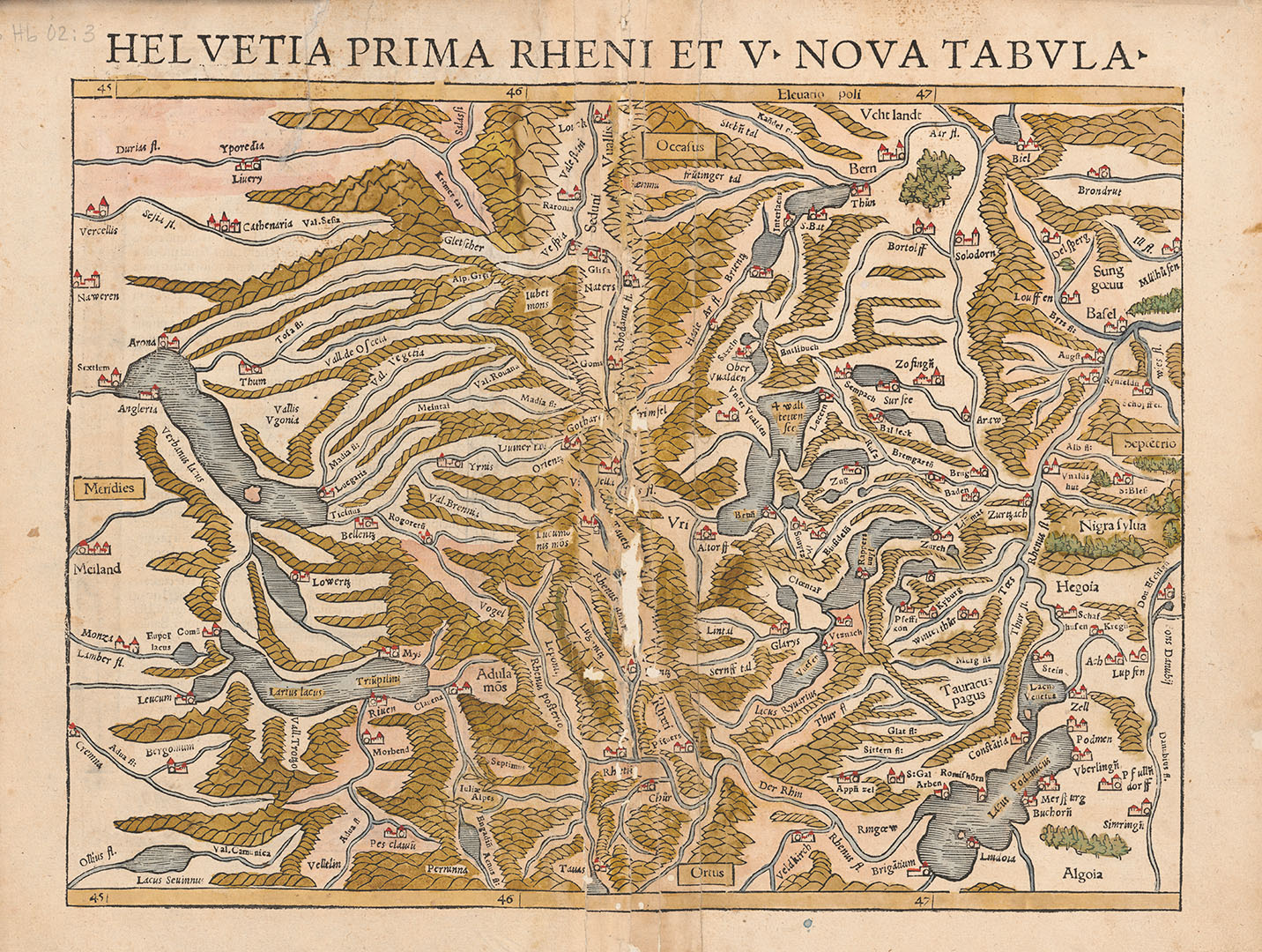
The extensive collection of 645 maps of Switzerland includes highlights such as the “Helvetia prima Rheni et V. nova tabula” from Sebastian Münster’s 1540 “Geographia universalis”. This map, which looks unusual to the modern eye owing to its westward orientation, is a coloured woodcut. The cartography is heavily distorted, and the mountain ranges are depicted graphically as small, scale-like accumulations.
Ranking
|
Name |
Reference points marked |
| 8024
|
|
| 4514
|
|
|
2335 |
|
| 2186
|
|
| 703
|
|
|
240 |
|
| 191
|
|
|
186 |
|
|
118 |
|
|
117 |
Contact
If you have any questions or comments about the project, please contact us.
Maps and panoramas